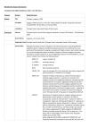
PDF with MetaData for Seagrass GIS datasets.…
This dataset shows the extent and basic types of sea grass areas around Pohnpei. It classifies sea grass areas by one of the three main species (Cymodocea rotundata, Thalassia hemprichii, and Enhalus acaroides) and the level of coverage (describes as continuous, aggregated, and isolated). The data source is McKenzie, L.J. and Rasheed, M.J. (2006), Seagrasses: Pohnpei Island and And Atoll Marine Assessment, Technical report of survey conducted 26 October 3 November 2005, SeagrassWatch HQ, DPI&F, Cairns, 60pp.
The dataset is included the Digital Atlas of Micronesia, module Pohnpei, by Island Research & Education Initiative (iREi), in collaboration with Water and Environmental Research Institute of the Western Pacific (WERI) University of Guam and partial funding from United States Geological Survey (USGS), under WRRI 104-B Program, project # 2016GU302B.
Data and Resource
| Field | Value |
|---|---|
| Publisher | Department of Environment, Climate Change & Emergency Management (DECEM), FSM |
| Modified | |
| Release Date | |
| Source URL | http://www.islands.fm/atlas/#/pohnpei-state |
| Identifier | 9c5cc55e-6480-4e19-862c-a43c9703bbe6 |
| Spatial / Geographical Coverage Location | Federated States of Micronesia |
| Relevant Countries | Federated States of Micronesia |
| License |
SPREP Public Licence
![[Open Data]](https://assets.okfn.org/images/ok_buttons/od_80x15_blue.png)
|

